Your XC Planning Should Start Where Others Stop!
Real XC planning goes beyond weather checks and GPS waypoints. Master pilots think in thermal cycles and energy zones, not rigid turn points. Discover the distance-based method that adapts to changing
Beyond the Forecast: The Real Art of XC Planning
Most pilots think XC planning ends when they've checked the weather forecast and marked a few waypoints on their GPS. They study the wind direction, eye the thermal strength predictions, and call it good. But here's the truth that separates the pilots who consistently nail their planned routes from those who land short wondering what went wrong: your planning should start where others stop.
Real XC planning isn't about plotting a perfect line on your phone the night before. It's about understanding thermal cycles, energy zones, and building a flexible framework that adapts to the mountain's mood. Let's dive into the distance-based planning method that will transform how you think about cross-country flight.
Think in Thermal Cycles, Not Turn Points
Traditional route planning focuses on waypoints: "I'll thermal here, then glide to there, then climb again at that ridge." This rigid thinking falls apart the moment conditions shift—and conditions always shift.
Instead, start thinking in thermal cycles and energy zones. A thermal cycle in most mountain regions runs 15-25 minutes. During this window, you're not just looking for the next thermal—you're positioning yourself within an energy zone that will support your next 20-30 kilometer segment.
Here's how this changes your approach: Rather than marking specific thermal sources, identify energy corridors—areas where thermal activity typically develops throughout the day. These might be south-facing valley walls, convergence zones, or reliable trigger points that work across different wind directions.
The Distance-Based Framework
Plan your route in 20-30 km segments, each representing roughly one thermal cycle. For each segment, identify:
Primary energy zone: Your most likely thermal source area
Backup options: Alternative energy sources if conditions shift
Commitment points: Where you must decide to continue or bail to a landing
Escape routes: Safe glide-to-land options throughout the segment
This framework gives you strategic direction while maintaining tactical flexibility—exactly what you need when the atmosphere doesn't read the weather forecast.
The Hidden Layers: Topology, History, and Time Windows
While most pilots stop at surface weather analysis, the real insights come from layering additional data sources that reveal the mountain's patterns.
Historical Track Analysis
Study successful XC tracks from similar conditions over the past 2-3 years. Don't just look at the routes—analyze the timing. When did pilots typically climb out of certain valleys? Where do tracks consistently show strong climbs versus areas where everyone seems to struggle?
Tools like Xcontest or Leonardo Global Flight Database provide this historical perspective. Look for patterns: Do pilots consistently take the eastern route in light north winds? Is there a time window where the western valley becomes unflyable due to overdevelopment?
Topology as Your Co-Pilot
Terrain shapes airflow in ways that weather models can't fully capture. That innocent-looking saddle might channel wind into a venturi effect. The broad valley floor that looks perfect for thermals might create a massive sink zone in certain conditions.
Study your route's topology with these questions:
Where will terrain acceleration occur?
Which ridges will work as thermal triggers versus wind shadows?
How will the sun angle affect thermal development throughout your planned flight time?
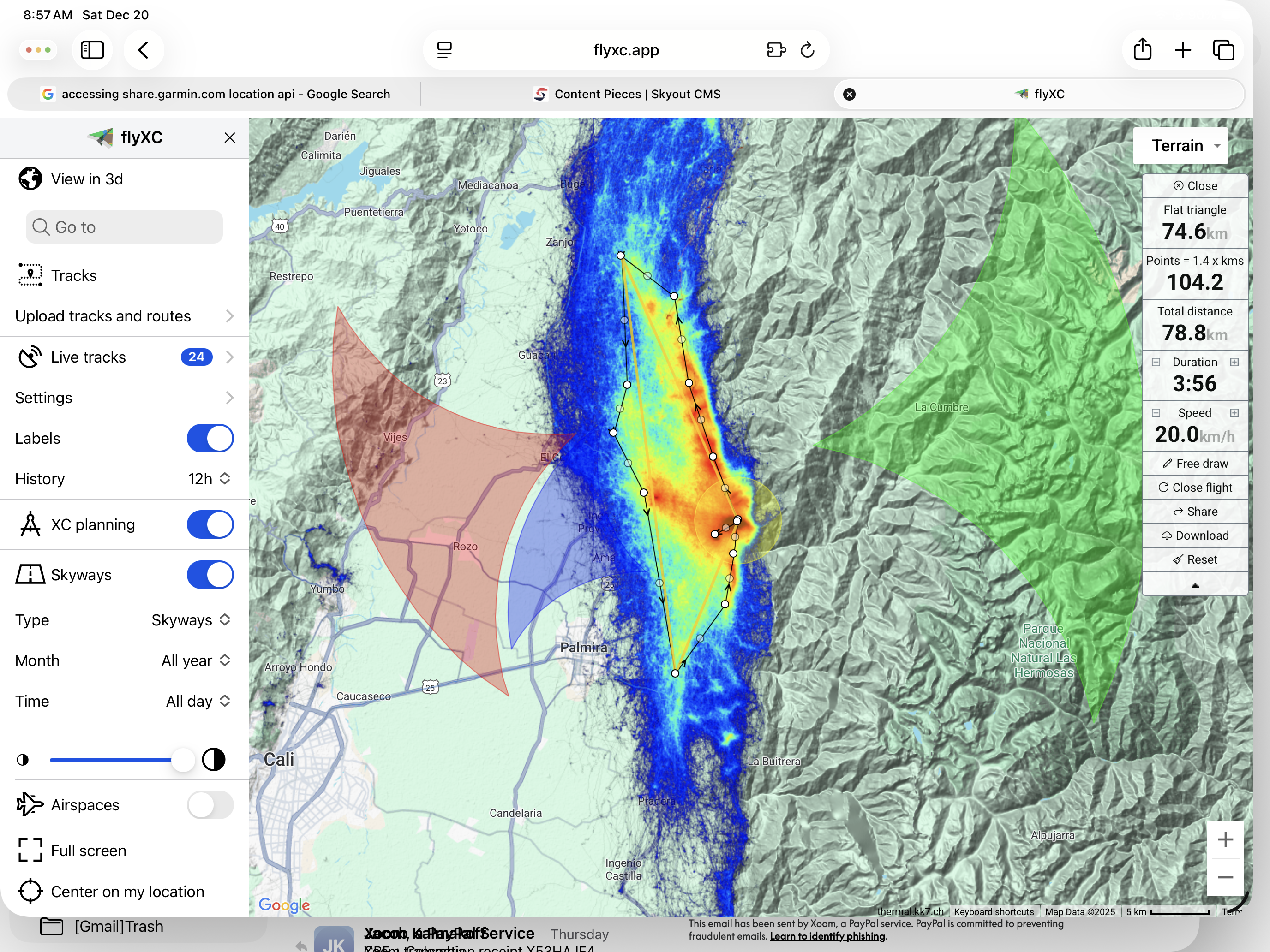
Source: FlyXC.app
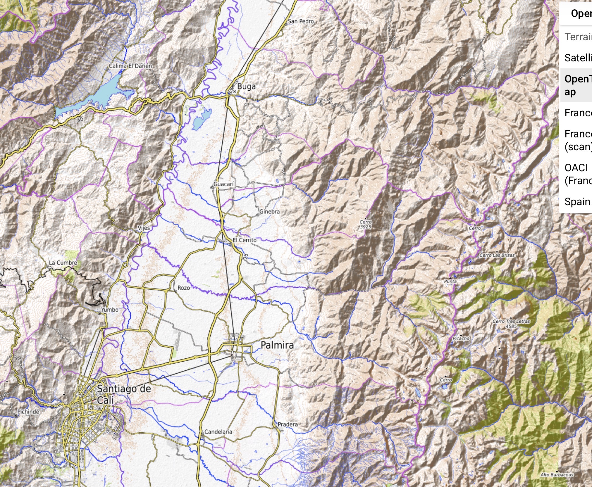
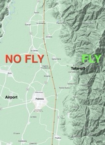
The Airspace Layer: Learning from Valle del Cauca
Airspace considerations often get treated as an afterthought, but they should fundamentally shape your route planning. As renowned pilot and instructor Pál Takáts noted in his excellent analysis of flying in his article Airspaces Valle del Cauca Colombia region: "Understanding airspace restrictions isn't just about staying legal—it's about understanding how controlled airspace affects thermal development and traffic patterns that can make or break your XC day."
Takáts emphasizes that military zones and controlled airspace often coincide with the best thermal sources, forcing pilots to make strategic compromises. Plan your route to work with airspace, not against it. Sometimes the longer route that avoids restricted zones actually provides better energy sources and less stress.
His key insight: "The areas just outside controlled airspace often have reduced air traffic and excellent thermal conditions—they're the sweet spots most pilots overlook because they're focused on the forbidden zones rather than the opportunities next door."
Time Windows: The Critical Fourth Dimension
Every XC route has optimal time windows that most pilots ignore. That mountain pass might be crossable at 2 PM but completely shut down by 4 PM due to overdevelopment. The coastal convergence might not fire until mid-afternoon, making it useless for morning starts.
Build time-sensitivity into your planning. Identify the latest you can realistically reach each segment while conditions still support it. This temporal framework often reveals why some routes work brilliantly on certain days and fail completely on others.
Your Strategic Advantage
When you plan beyond the weather forecast—incorporating thermal cycles, historical patterns, topological realities, airspace considerations, and time windows—you develop something most pilots lack: strategic adaptability.
You're not locked into a rigid plan that crumbles with the first unexpected sink. Instead, you have a flexible framework that lets you make smart decisions in real-time while maintaining your overall direction and goals.
This is where XC flying becomes art, not just athleticism. Start your next flight planning session where others stop, and discover how much more the mountains have to teach you.
References:
Airpaces - Valle De Cauca Colombia by Pal Takats
Leonardo Global Flight Database
FlyXC.app a very valuable tool to help with planning and generating the route files.
Tags: XC paragliding planning, cross-country paragliding, thermal cycles paragliding, paragliding route planning, XC flight planning, paragliding energy zones, advanced paragliding techniques, cross-country flight strategy